Henry Morton Stanley
My regular lunchtime cycle route takes me down Church Lane in Pirbright, a quiet and peaceful lane which passes St Michael and All Angels’ Church, a classic church in the Norman style founded in 1210 in the reign of King John, the king who is best remembered for granting the Magna Carta a few years later in 1215.
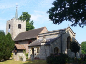
St Michaels & All Angels Church – image copyright Colin Smith – http://www.geograph.org.uk/profile/3972
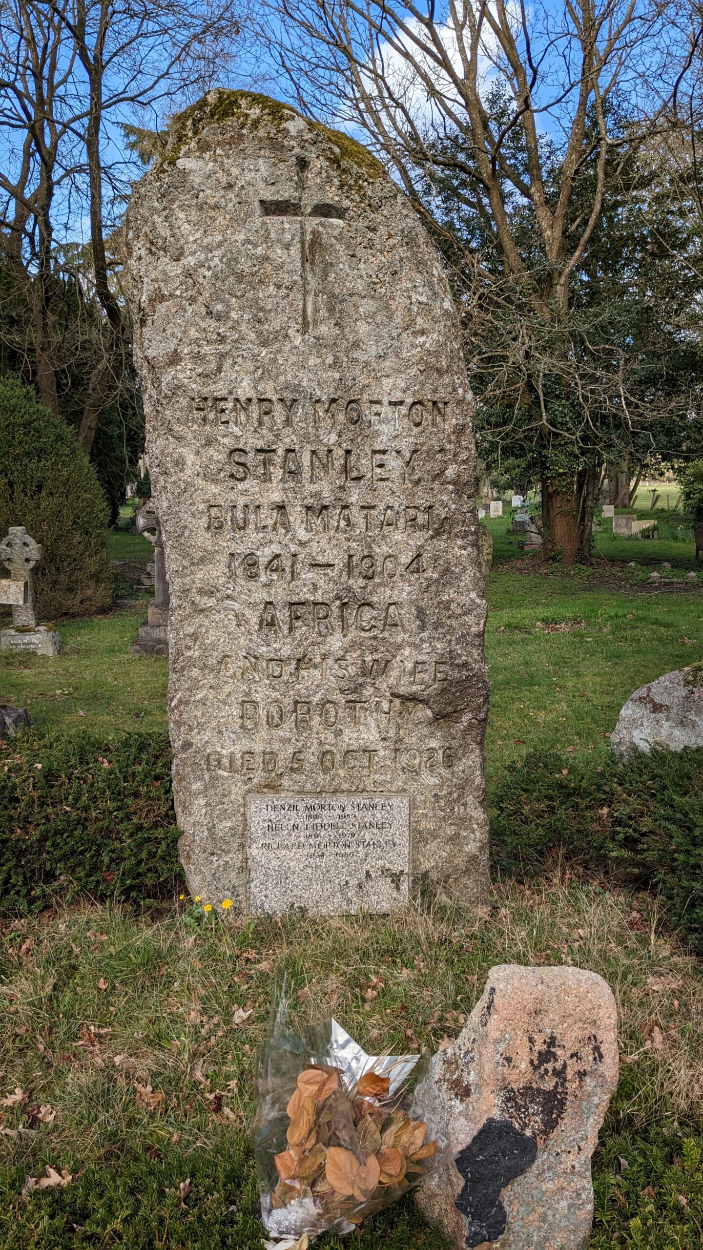
Headstone of Henry Morton Stanley, St Michael & All Angels’ Church, Pirbright
In spite of passing by the churchyard on many hundreds of occasions, I had never noticed the massive granite gravestone in the churchyard which marks the final resting place of one of the country’s leading explorers, Sir Henry Morton Stanley, the man who famously located the missing Dr Livingstone at Ujiji, a village on the shores of Lake Tanganyika (now Tanzania) in November 1871. I can thank my wife for her superior skills of observation for pointing out the gravestone to me, though in fairness, the size and scale of it really shouldn’t have escaped even the most inattentive of passers by, even those chasing a Strava personal best!
The headstone itself is made from a large piece of Dartmoor granite and is inscribed with the words
Henry Morton Stanley, Bula Matari, 1841–1904, Africa
Bula Matari translates as “Breaker of Rocks” in Kongo and apparently (according to Wikipedia at least) was Stanley’s name among locals in Congo.
Today Henry Morton Stanley is remembered for his role in the early European explorations of Africa, for his road building (hence the rock breaking moniker) and for helping to open the African continent for European expansion in the Age of Imperialism. As such, he is considered to be a significant but also a controversial historical figure due to how his explorations impacted the lives of the African people – for more on his disputed legacy, see Henry Morton Stanley: hero or villain?
Back to the route..!
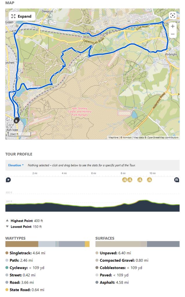
This is a shortish route of 12 miles or so, starting out from Ash Vale station, travelling north and then east along the Basingstoke Canal, past the 14 locks at Deepcut, descending gently down into Brookwood before returning via Pirbright and the MOD ranges to the east of the Basingstoke Canal Centre – these have the benefit of being mostly open to the public and not restricted by military firing which limits access further to the south on Cleygate Common (the Danger Area as marked on OS maps). If you have the time it’s well worth a visit to the aforesaid Canal Centre at Mytchett, as there is an information exhibition on the history of the canal as well as an independent cafe which serves an excellent selection of refreshments.
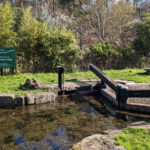
Deepcut Flight Top
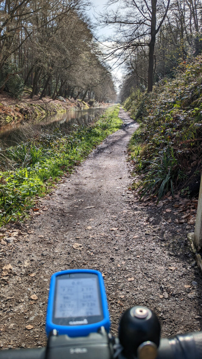
The section from Ash Vale to Frimley Lodge Park can get busy with pedestrians and/or dog walkers, but after crossing the bridge by The King’s Head and rejoining the canal on the other side, the (newly resurfaced!) gravel path is much quieter as you turn east near Deepcut past some advantageously located canal-side houses with lovely terraced gardens.
After a short while, you will come to the first (the “Flight Top”) of the Deepcut Locks which then gradually wend their way down towards Brookwood. The peace and quiet is occasionally broken by the shrillness of a speeding train on the South Western Line which runs parallel, the modern transport link contrasting starkly with its water borne predecessor, the slower but more tranquil mode of conveyance which briefly dominated in the early 1800s before the railways took over.
At the time of writing (April 2023), the path becomes a little muddy in the mid section as you pass Bisley Camp across the water on your left, but is easily passable. The final stretch into Brookwood itself though is a little firmer under wheel.
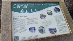
The local and long-standing association with the military is obvious along much of this route, and rather helpfully, the Canal Society has recently updated many of its information boards along the length of the canal path which provide some interesting background and explanations of local military history and canal side constructions as well as the topography and wildlife which are such a feature of the area.
Today, we leave the canal at Brookwood, though it does continue on for another eight miles or so to meet the Wey Navigation at New Haw, before joining the Thames at Weybridge. We’re heading on the main road for a mile or so past Brookwood Cemetery on our left towards Pirbright to stop off at the church (see above).
After leaving the churchyard at St Michaels and All Angels’, we rejoin the main road heading west (Grange Road) going past the Stoney Castle Range on our left and climb to the junction with Mytchett Place Road, where we cross to join a steep descent down a single track path that takes us under the Alton branch line onto gravel tracks through the forest – there are also plenty of options here to leave the gravel in search of some single track fun for the thrill seekers and dirt junkies among us! Today we are time limited so rejoin the road just before Mytchett to get back to Ash Vale, but if you have time, and the legs, it’s well worth exploring the trails around here and then swooping down for refreshments at the Canal Centre cafe or to head south along the canal path to the Swan for something a little stronger!
Route Overview and GPX file
Start/Finish: Ash Vale Station (what3words: ///rail.guises.mild)
Route length: 11.8 miles
Elevation: 375 feet
Bike suitability: Mountain Bikes/Gravel Bikes/Hybrids
Allow: 90 mins to 2 hours
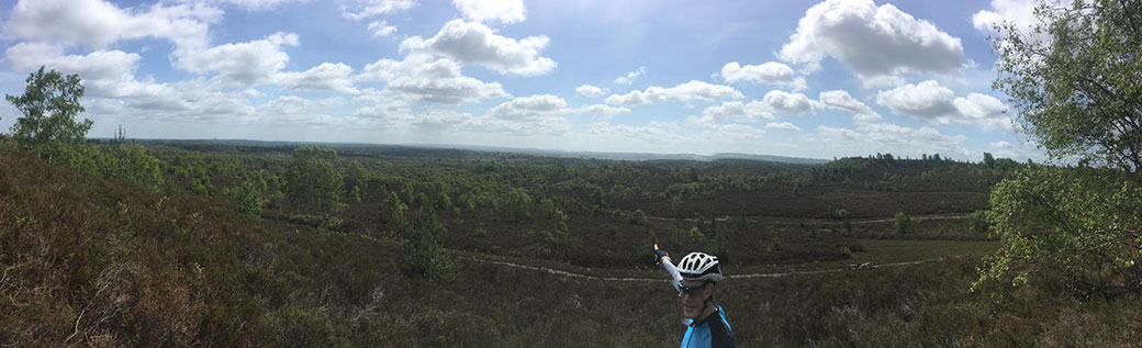
Subject to MOD range opening times, the route can be extended easily by exploring the Ash Ranges south of Mytchett Place Road and east of Ash Vale station – check access via the MOD South East Training Estate firing times. Much of the perimeter has a good quality gravel fire road while the openness of the central area (Romping Downs, Lookout Hill) affords excellent views of the Hog’s Back and Guildford Cathedral, and, if you are lucky to have a clear day, the London skyline 40 miles away.